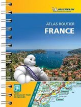
Philip's Road Atlases- Philip's Handy Road Atlas France, Belgium and The Netherlands Spiral A5
Afbeeldingen
Sla de afbeeldingen overArtikel vergelijken
Auteur:
Philip's Maps
- Engels
- Spiraalgebonden
- 9781849075565
- 03 juni 2021
- 64 pagina's
Samenvatting
Philip's Handy Road Atlas of France, Belgium and The Netherlands features new digital cartography from Philip's - voted Britain's clearest and most detailed European mapping in an independent consumer survey. This compact A5 atlas with lie-flat binding is perfect for travelling across France and the surrounding countries.
Productspecificaties
Wij vonden geen specificaties voor jouw zoekopdracht '{SEARCH}'.
Inhoud
- Taal
- en
- Bindwijze
- Spiraalgebonden
- Oorspronkelijke releasedatum
- 03 juni 2021
- Aantal pagina's
- 64
Betrokkenen
- Hoofdauteur
- Philip's Maps
- Hoofduitgeverij
- Philip's
Overige kenmerken
- Product breedte
- 156 mm
- Product hoogte
- 6 mm
- Product lengte
- 208 mm
- Studieboek
- Nee
- Verpakking breedte
- 156 mm
- Verpakking hoogte
- 6 mm
- Verpakking lengte
- 208 mm
- Verpakkingsgewicht
- 120 g
EAN
- EAN
- 9781849075565
Je vindt dit artikel in
- Categorieën
- Regio
- West-Europa, Benelux
- Taal
- Engels
- Beschikbaarheid
- Leverbaar
Kies gewenste uitvoering
Bindwijze
: Spiraalgebonden
Prijsinformatie en bestellen
De prijs van dit product is 9 euro en 99 cent.
Uiterlijk 5 juni in huis
Verkoop door bol
- Gratis verzending door bol vanaf 20 euro
- Ophalen bij een bol afhaalpunt mogelijk
- 30 dagen bedenktijd en gratis retourneren
- Dag en nacht klantenservice
Anderen bekeken ook

Rapporteer dit artikel
Je wilt melding doen van illegale inhoud over dit artikel:
- Ik wil melding doen als klant
- Ik wil melding doen als autoriteit of trusted flagger
- Ik wil melding doen als partner
- Ik wil melding doen als merkhouder
Geen klant, autoriteit, trusted flagger, merkhouder of partner? Gebruik dan onderstaande link om melding te doen.