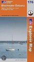
Blackwater Estuary
Afbeeldingen
Sla de afbeeldingen overArtikel vergelijken
- 9780319237793
Ordnance Survey
"Ordnance Survey (OS) is a national mapping agency in the United Kingdom which covers the island of Great Britain. It is one of the world's largest producers of maps. Since 1 April 2015 it has operated as Ordnance Survey Ltd, a government-owned company, 100% in public ownership. The Ordnance Survey Board remains accountable to the Secretary of State for Business, Energy and Industrial Strategy. It is also a member of the Public Data Group.
(Bron: Wikipedia. Beschikbaar onder de licentie Creative Commons Naamsvermelding/Gelijk delen.)"
(Bron: Wikipedia. Beschikbaar onder de licentie Creative Commons Naamsvermelding/Gelijk delen.)"
Samenvatting
OS Explorer Map is the Ordnance Survey's most detailed map and is recommended for anyone enjoying outdoor activities such as walking, horse riding and off-road cycling. The series provides complete GB coverage and can now be used in all weathers thanks to OS Explorer Map - Active, a tough, versatile version of the OS Explorer Map.
Productspecificaties
Wij vonden geen specificaties voor jouw zoekopdracht '{SEARCH}'.
Betrokkenen
- Hoofdauteur
- Ordnance Survey
- Hoofduitgeverij
- Ordnance Survey
Overige kenmerken
- Editie
- A1
- Product breedte
- 126 mm
- Product hoogte
- 14 mm
- Product lengte
- 228 mm
- Verpakking breedte
- 126 mm
- Verpakking hoogte
- 14 mm
- Verpakking lengte
- 240 mm
- Verpakkingsgewicht
- 118 g
EAN
- EAN
- 9780319237793
Je vindt dit artikel in
- Categorieën
- Taal
- Engels
- Boek, ebook of luisterboek?
- Boek
- Beschikbaarheid
- Leverbaar
- Studieboek of algemeen
- Algemene boeken
Kies gewenste uitvoering
Kies je bindwijze
(3)
Prijsinformatie en bestellen
De prijs van dit product is 32 euro en 22 cent. Dit is een tweedehands product.Alleen tweedehands
Goed
Ref9210
Ref9210
Uiterlijk 6 juni in huis
Verkoop door
BAY EXPRESS
- Bestellen en betalen via bol
- Prijs inclusief verzendkosten, verstuurd door BAY EXPRESS
- 30 dagen bedenktijd en gratis retourneren
Shop dit artikel
Anderen bekeken ook
Rapporteer dit artikel
Je wilt melding doen van illegale inhoud over dit artikel:
- Ik wil melding doen als klant
- Ik wil melding doen als autoriteit of trusted flagger
- Ik wil melding doen als partner
- Ik wil melding doen als merkhouder
Geen klant, autoriteit, trusted flagger, merkhouder of partner? Gebruik dan onderstaande link om melding te doen.