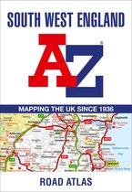
Eastern England A-Z Road Atlas
Afbeeldingen
Sla de afbeeldingen overArtikel vergelijken
Uitgever: HarperCollins
- Engels
- Paperback
- 9780008652821
- 04 juli 2024
- 72 pagina's
Samenvatting
A full-colour, regional road atlas from A-Z Maps. Featuring more than 50 pages of continuous mapping of regions in the east of England.
A full-colour, regional road atlas from A-Z Maps. Featuring more than 50 pages of continuous mapping of regions in the east of England.
A full-colour, regional road atlas from A-Z Maps. Featuring more than 50 pages of continuous mapping of regions in the east of England.
Published at a clear 2.5 miles to 1 inch the following features are shown on the road mapping:
- Motorways with full junction detail, primary routes and destinations, A & B roads, under construction and proposed roads, service areas, tolls, mileages, county and unitary authority boundaries
- National Park boundaries
- Selected places of interest and tourist information centres
- Separate city, town, airport, and port plans
The comprehensive index section lists cities, towns, villages, hamlets and locations covered by this atlas.
Productspecificaties
Wij vonden geen specificaties voor jouw zoekopdracht '{SEARCH}'.
Inhoud
- Taal
- en
- Bindwijze
- Paperback
- Oorspronkelijke releasedatum
- 04 juli 2024
- Aantal pagina's
- 72
Betrokkenen
- Hoofduitgeverij
- HarperCollins
Overige kenmerken
- Product breedte
- 170 mm
- Product hoogte
- 5 mm
- Product lengte
- 245 mm
- Verpakking breedte
- 170 mm
- Verpakking hoogte
- 5 mm
- Verpakking lengte
- 245 mm
- Verpakkingsgewicht
- 270 g
EAN
- EAN
- 9780008652821
Je vindt dit artikel in
- Taal
- Engels
- Beschikbaarheid
- Te reserveren
- Boek, ebook of luisterboek?
- Boek
Kies gewenste uitvoering
Bindwijze
: Paperback
Prijsinformatie en bestellen
De prijs van dit product is 8 euro en 99 cent.
Nog niet verschenen - reserveer een exemplaar
Beschikbaar op 04-07-2024
Verkoop door bol
- Gratis verzending door bol vanaf 20 euro
- Ophalen bij een bol afhaalpunt mogelijk
- 30 dagen bedenktijd en gratis retourneren
- Dag en nacht klantenservice
Rapporteer dit artikel
Je wilt melding doen van illegale inhoud over dit artikel:
- Ik wil melding doen als klant
- Ik wil melding doen als autoriteit of trusted flagger
- Ik wil melding doen als partner
- Ik wil melding doen als merkhouder
Geen klant, autoriteit, trusted flagger, merkhouder of partner? Gebruik dan onderstaande link om melding te doen.


