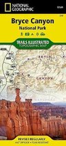
Glacier/waterton Lakes National Parks Trails Illustrated National Parks
Afbeeldingen
Sla de afbeeldingen overArtikel vergelijken
- Engels
- Losbladig
- 9781566953184
- 26 september 2013
- 1 pagina's
Samenvatting
• Waterproof • Tear-Resistant • Topographic Map
National Geographic's Trails Illustrated map of Glacier and Waterton Lakes National Parks offers unparalleled detail for outdoor enthusiasts exploring the pristine landscape of forests, mountains, lakes, and meadows within these two spectacular parks. Created in partnership with local land management agencies, this expertly researched map features key areas of interest including Many Glacier, Great Bear Wilderness, Flathead National Forest, Hungry Horse Reservoir, Lake McDonald, Flathead River, St. Mary Lake, Akamina-Kishinena Provincial Park, and the Waterton Lakes.
The Glacier and Waterton Lakes map is an invaluable resource for exploring the more than 800 miles of mapped trails within the parks, including the Pacific Northwest Trail, the Continental Divide Trail, and recommended biking trails. Recreation features are clearly marked, including campgrounds, trailheads, interpretive trails, fishing and boat access, and horse rental locations. The map base includes contour lines and elevations for summits, passes and major lakes. A variety of helpful information about recreation activities available in the parks, hiking and backcountry camping, regulations, and safety tips are included as well.
Every Trails Illustrated map is printed on ''Backcountry Tough'' waterproof, tear-resistant paper. A full UTM grid is printed on the map to aid with GPS navigation.
Other features found on this map include: Apgar Mountains, Bowman Lake, Flathead National Forest, Flathead Range, Glacier, Great Bear Wilderness, Kintla Lake, Lake McDonald, Lake Sherburne, Lewis & Clark National Forest, Lewis Range, Livingston Range, Lower Saint Mary Lake, Mount Carter, Mount Cleveland, Mount Saint Nicholas, Mount Stimson, Saint Mary Lake, Upper Waterton Lake, Whitefish Lake.
- Map Scale = 1:100,000
- Sheet Size = 37.75'' x 25.5''
- Folded Size = 4.25'' x 9.25''
Productspecificaties
Wij vonden geen specificaties voor jouw zoekopdracht '{SEARCH}'.
Inhoud
- Taal
- en
- Bindwijze
- Losbladig
- Oorspronkelijke releasedatum
- 26 september 2013
- Aantal pagina's
- 1
- Illustraties
- Nee
Betrokkenen
- Hoofdauteur
- National Geographic Maps
- Hoofduitgeverij
- National Geographic Maps
Overige kenmerken
- Editie
- 2009
- Extra groot lettertype
- Nee
- Product breedte
- 110 mm
- Product hoogte
- 6 mm
- Product lengte
- 235 mm
- Studieboek
- Nee
- Verpakking breedte
- 110 mm
- Verpakking hoogte
- 5 mm
- Verpakking lengte
- 235 mm
- Verpakkingsgewicht
- 98 g
EAN
- EAN
- 9781566953184
Kies gewenste uitvoering
Bindwijze
: Losbladig
Prijsinformatie en bestellen
De prijs van dit product is 13 euro en 77 cent.
2 - 3 weken
Verkoop door bol
- Gratis verzending door bol vanaf 20 euro
- Ophalen bij een bol afhaalpunt mogelijk
- 30 dagen bedenktijd en gratis retourneren
- Dag en nacht klantenservice
Anderen bekeken ook


Rapporteer dit artikel
Je wilt melding doen van illegale inhoud over dit artikel:
- Ik wil melding doen als klant
- Ik wil melding doen als autoriteit of trusted flagger
- Ik wil melding doen als partner
- Ik wil melding doen als merkhouder
Geen klant, autoriteit, trusted flagger, merkhouder of partner? Gebruik dan onderstaande link om melding te doen.