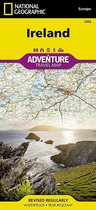
Hawaii Travel Maps International Adventure Map
Afbeeldingen
Sla de afbeeldingen overArtikel vergelijken
- Engels
- Losbladig
- 9781566956512
- 28 september 2012
- 1 pagina's
Samenvatting
&; Waterproof &; Tear-Resistant &; Travel Map
A warm tropical climate, an abundance of white sand beaches and diverse natural scenery make the Hawaiian Islands a popular travel destination. Covering the eight main islands in their entirety, National Geographic's Hawai'i Adventure Map was designed with the functionality to serve the needs of adventure travelers. With hundreds of diverse natural and man-made destinations pinpointed, the map delivers unparalleled content, not readily available on traditional road maps. The state's highways and main road network is shown with mileage markers. Smaller roads and interisland ferry routes are also mapped to help you get off the beaten path. The location of cities and towns is listed in a user-friendly index.
The Islands' most popular hotspots, like Hawai'i Volcanoes National Park, the USS Arizona Memorial, Haleakala National Park, Pu'uhonua o Honaunau National Historical Park, Hanauma Bay Nature Preserve and Waimea Canyon are all marked on the map, as are many hidden gems. Other recreational historical and cultural features include hiking trails, beaches, surfing areas, archeological sites, zoos, golf courses, caves, springs, campsites and scenic viewpoints. The boundaries of National Parks, Conservation Areas, Natural Reserves and Wildlife Refuges are all clearly marked. With such a wealth of content, the map is an ideal complement to National Geographic's Hawaii Traveler's Guide or any other guidebook to the area.
Every Adventure Map is printed on durable synthetic paper, making them waterproof, tear-resistant and tough &; capable of withstanding the rigors of international travel.
- Map Scale = 1:220,000
- Sheet Size = 25.5'' x 37.75''
- Folded Size = 4.25'' x 9.25''
Productspecificaties
Wij vonden geen specificaties voor jouw zoekopdracht '{SEARCH}'.
Inhoud
- Taal
- en
- Bindwijze
- Losbladig
- Oorspronkelijke releasedatum
- 28 september 2012
- Aantal pagina's
- 1
- Illustraties
- Nee
Betrokkenen
- Hoofdauteur
- National Geographic Maps
- Hoofduitgeverij
- National Geographic Maps
Overige kenmerken
- Editie
- 2022
- Extra groot lettertype
- Nee
- Product breedte
- 108 mm
- Product hoogte
- 5 mm
- Product lengte
- 235 mm
- Studieboek
- Nee
- Verpakking breedte
- 108 mm
- Verpakking hoogte
- 7 mm
- Verpakking lengte
- 234 mm
- Verpakkingsgewicht
- 1 g
EAN
- EAN
- 9781566956512
Kies gewenste uitvoering
Bindwijze
: Losbladig
Prijsinformatie en bestellen
De prijs van dit product is 15 euro en 95 cent. De meest getoonde prijs is 18 euro en 99 cent. Je bespaart 16%.
Je bespaart 16%
Verkoop door bol
- Gratis verzending door bol vanaf 20 euro
- Ophalen bij een bol afhaalpunt mogelijk
- 30 dagen bedenktijd en gratis retourneren
- Dag en nacht klantenservice
Bezorgopties
- Vandaag nog in huis (bestel ma-vr voor 12:00, bezorging tussen 17:00 en 22:00)
- Doordeweeks ook ’s avonds in huis
- Ook zondag in huis (bestel voor za 23:59)
Anderen bekeken ook


Vaak samen gekocht


Rapporteer dit artikel
Je wilt melding doen van illegale inhoud over dit artikel:
- Ik wil melding doen als klant
- Ik wil melding doen als autoriteit of trusted flagger
- Ik wil melding doen als partner
- Ik wil melding doen als merkhouder
Geen klant, autoriteit, trusted flagger, merkhouder of partner? Gebruik dan onderstaande link om melding te doen.