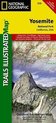
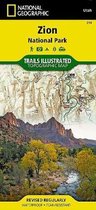
Yosemite National Park 206 GPS Californi Trails Illustrated National Parks
Afbeeldingen
Sla de afbeeldingen overArtikel vergelijken
- Engels
- Paperback
- 9781566952996
- 02 augustus 2012
- 1 pagina's
Samenvatting
• Waterproof • Tear-Resistant • Topographic Map
Explore the majesty of Yosemite National Park with National Geographic's Trails Illustrated map. Loaded with helpful information on camping, hiking, lodging, transportation, regulations, and safety, this map is an invaluable tool for casual park visitors and avid adventurers alike. Expertly researched and created in partnership with local land management agencies, the map features key areas of interest including Stanislaus National Forest, Emigrant Wilderness, Carson Iceberg Wilderness, Toiyabe National Forest, Hoover Wilderness, Inyo National Forest, Yosemite Wilderness, Sierra National Forest, and Ansel Adams Wilderness. Detail of the popular Tuolumne Meadows and Yosemite Valley are provided in inset maps.
With almost 800 miles of mapped trails, the Yosemite National Park map can guide you off the beaten path and back again. The clearly marked trails include mileages between intersections. The map base includes contour lines and elevations for summits, passes and major lakes. Some of the many recreation features include: campgrounds, trailheads, tram tours, ski areas, river access, scenic overlooks, scenic byways, and interpretive trails.
Every Trails Illustrated map is printed on ''Backcountry Tough'' waterproof, tear-resistant paper. A full UTM grid is printed on the map to aid with GPS navigation.
Other features found on this map include: Ansel Adams Wilderness, Bridalveil Fall, Cathedral Range, El Capitan, Emigrant Wilderness, Excelsior Mountain, Hoover Wilderness, Illilouette Falls, Inyo National Forest, Lake Eleanor, Lower Yosemite Fall, Matterhorn Peak, Mount Dana, Mount Lyell, Mount Ritter, Nevada Fall, Ribbon Fall, Ritter Range, Sierra National Forest, Silver Strand Falls, Stanislaus National Forest, Tioga Pass, Toiyabe National Forest, Upper Yosemite Falls, Vernal Fall, Yosemite National Park, Yosemite Valley.
- Map Scale = 1:80,000 & 1:40,000
- Sheet Size = 37.75'' x 25.5''
- Folded Size = 4.25'' x 9.25''
Productspecificaties
Inhoud
- Taal
- en
- Bindwijze
- Paperback
- Oorspronkelijke releasedatum
- 02 augustus 2012
- Aantal pagina's
- 1
- Illustraties
- Nee
Betrokkenen
- Hoofdauteur
- National Geographic Maps
- Hoofdredacteur
- National Geographic Maps
- Hoofduitgeverij
- INGP
Overige kenmerken
- Editie
- 2019
- Extra groot lettertype
- Nee
- Product breedte
- 108 mm
- Product hoogte
- 9 mm
- Product lengte
- 235 mm
- Studieboek
- Nee
- Verpakking breedte
- 114 mm
- Verpakking hoogte
- 234 mm
- Verpakking lengte
- 9 mm
- Verpakkingsgewicht
- 88 g
EAN
- EAN
- 9781566952996
Je vindt dit artikel in
- Categorieën
- Regio
- Californië
- Taal
- Engels
- Boek, ebook of luisterboek?
- Boek
Reviews
Negatief, positief, neutraal: we zetten een review altijd online. We controleren wel eerst of ’ie voldoet aan onze reviewvoorwaarden en niet nep is. We controleren ook of ’ie is geschreven door iemand die het artikel heeft gekocht via bol.com en zetten dit er dan bij. De controles gebeuren automatisch, al kijken er soms mensen mee. Bol.com betaalt niet voor reviews. Als een reviewer door een andere partij is vergoed, staat dit in de review zelf.
Negatief, positief, neutraal: we zetten een review altijd online. We controleren wel eerst of ’ie voldoet aan onze reviewvoorwaarden en niet nep is. We controleren ook of ’ie is geschreven door iemand die het artikel heeft gekocht via bol.com en zetten dit er dan bij. De controles gebeuren automatisch, al kijken er soms mensen mee. Bol.com betaalt niet voor reviews. Als een reviewer door een andere partij is vergoed, staat dit in de review zelf.
-
Onmisbaar
Positieve punten
- Toegankelijk
- Praktisch toepasbaar
Heb hem nog niet gebruikt, maar het feit dat de hoogtes erop aangegeven staan zal zeker van pas komen. Ideaal dat de kaart ook waterafstotend is.
Vond je dit een nuttige review?00 -
wat een groot park
Positieve punten
- geef ideeen voor u verblijf
Negatieve punten
- o wat een groot nationalpark
zo krijg je al verschillende ideeen voor u start.
Vond je dit een nuttige review?00
Kies gewenste uitvoering
Prijsinformatie en bestellen
De prijs van dit product is 15 euro en 99 cent.- Gratis verzending door bol vanaf 20 euro
- Ophalen bij een bol afhaalpunt mogelijk
- 30 dagen bedenktijd en gratis retourneren
- Dag en nacht klantenservice
Anderen bekeken ook


Vaak samen gekocht

Rapporteer dit artikel
Je wilt melding doen van illegale inhoud over dit artikel:
- Ik wil melding doen als klant
- Ik wil melding doen als autoriteit of trusted flagger
- Ik wil melding doen als partner
- Ik wil melding doen als merkhouder
Geen klant, autoriteit, trusted flagger, merkhouder of partner? Gebruik dan onderstaande link om melding te doen.