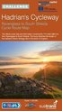
Hadrian's Cycleway Sustrans' Official Cycle Route Map for Ravenglass to Tynemouth
Afbeeldingen
Sla de afbeeldingen overArtikel vergelijken
- Engels
- Paperback
- 9781901389616
- 01 mei 2006
Productbeschrijving
The Discover Series of Sustrans official cycle route maps provide clearly mapped cycle routes on traffic-free paths, quiet lanes and traffic-calmed roads. They feature easy to read contours and route profiles. They offer visitor information and detailed routes through towns. They come in a splash-proof plastic sleeve. This is the Official Route Map covering 170 miles of the National Cycle Network (and other cycle routes), stretching the length of Hadrian's Wall World Heritage Site in the North of England.
Productspecificaties
Wij vonden geen specificaties voor jouw zoekopdracht '{SEARCH}'.
Inhoud
- Taal
- en
- Bindwijze
- Paperback
- Oorspronkelijke releasedatum
- 01 mei 2006
- Illustraties
- Nee
Betrokkenen
- Hoofduitgeverij
- Sustrans
Overige kenmerken
- Editie
- New title
- Product breedte
- 140 mm
- Product hoogte
- 12 mm
- Product lengte
- 231 mm
- Verpakking breedte
- 138 mm
- Verpakking hoogte
- 7 mm
- Verpakking lengte
- 241 mm
- Verpakkingsgewicht
- 74 g
EAN
- EAN
- 9781901389616
Je vindt dit artikel in
- Categorieën
-
Kies gewenste uitvoering
Bindwijze
: Paperback
Prijsinformatie en bestellen
De prijs van dit product is 37 euro en 30 cent. Dit is een tweedehands product.Alleen tweedehands
Goed
.
.
1 - 2 weken
Verkoop door
BAY EXPRESS
- Bestellen en betalen via bol
- Prijs inclusief verzendkosten, verstuurd door BAY EXPRESS
- 30 dagen bedenktijd en gratis retourneren
Shop dit artikel
Anderen bekeken ook

Rapporteer dit artikel
Je wilt melding doen van illegale inhoud over dit artikel:
- Ik wil melding doen als klant
- Ik wil melding doen als autoriteit of trusted flagger
- Ik wil melding doen als partner
- Ik wil melding doen als merkhouder
Geen klant, autoriteit, trusted flagger, merkhouder of partner? Gebruik dan onderstaande link om melding te doen.