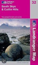
North Skye, Dunvegan and Portree
Afbeeldingen
Sla de afbeeldingen overArtikel vergelijken
- Engels
- Paperback
- 9780319480076
Ordnance Survey
"Ordnance Survey (OS) is a national mapping agency in the United Kingdom which covers the island of Great Britain. It is one of the world's largest producers of maps. Since 1 April 2015 it has operated as Ordnance Survey Ltd, a government-owned company, 100% in public ownership. The Ordnance Survey Board remains accountable to the Secretary of State for Business, Energy and Industrial Strategy. It is also a member of the Public Data Group.
(Bron: Wikipedia. Beschikbaar onder de licentie Creative Commons Naamsvermelding/Gelijk delen.)"
(Bron: Wikipedia. Beschikbaar onder de licentie Creative Commons Naamsvermelding/Gelijk delen.)"
Samenvatting
The OS Landranger Map - Active is an encapsulated product that is tough, durable and weatherproof. The maps are covered in a lightweight protective plastic coating that can be written on, so your favourite routes can be easily highlighted.
Productspecificaties
Wij vonden geen specificaties voor jouw zoekopdracht '{SEARCH}'.
Inhoud
- Taal
- en
- Bindwijze
- Paperback
- Illustraties
- Nee
Betrokkenen
- Hoofdauteur
- Ordnance Survey
- Hoofduitgeverij
- Ordnance Survey
Overige kenmerken
- Editie
- C1
- Product breedte
- 139 mm
- Product hoogte
- 24 mm
- Product lengte
- 231 mm
- Verpakking breedte
- 139 mm
- Verpakking hoogte
- 24 mm
- Verpakking lengte
- 240 mm
- Verpakkingsgewicht
- 157 g
EAN
- EAN
- 9780319480076
Je vindt dit artikel in
- Categorieën
- Taal
- Engels
- Boek, ebook of luisterboek?
- Boek
- Studieboek of algemeen
- Algemene boeken
- Beschikbaarheid
- Leverbaar
Kies gewenste uitvoering
Kies je bindwijze
(3)
Prijsinformatie en bestellen
De prijs van dit product is 41 euro en 37 cent. Dit is een tweedehands product.Alleen tweedehands
Goed
.
.
1 - 2 weken
Verkoop door
BAY EXPRESS
- Bestellen en betalen via bol
- Prijs inclusief verzendkosten, verstuurd door BAY EXPRESS
- 30 dagen bedenktijd en gratis retourneren
Anderen bekeken ook

Rapporteer dit artikel
Je wilt melding doen van illegale inhoud over dit artikel:
- Ik wil melding doen als klant
- Ik wil melding doen als autoriteit of trusted flagger
- Ik wil melding doen als partner
- Ik wil melding doen als merkhouder
Geen klant, autoriteit, trusted flagger, merkhouder of partner? Gebruik dan onderstaande link om melding te doen.