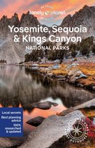
Sequoia Kings Canyon National Park Trails Illustrated National Parks
Afbeeldingen
Sla de afbeeldingen overArtikel vergelijken
Auteur:
National Geographic Maps
- Engels
- Paperback
- 9781566952989
- 02 augustus 2012
- 2 pagina's
Samenvatting
&; Waterproof &; Tear-Resistant &; Topographic Map
In Sequioa and Kings Canyon National Parks you can walk among the world's largest trees, hike the alpine landscape of the Sierra Crest, and marvel at the towering granite cliffs of one of the deepest canyons in the United States. National Geographic's Trails Illustrated map of Sequoia and Kings Canyon National Parks provides unmatched detail of these parks, meeting the needs of amateur and experienced outdoor enthusiasts alike. Created in partnership with local land management agencies, this expertly researched map features key areas of interest including Sequoia Grove; Giant Sequoia National Monument; John Muir, Golden Trout, Jennie Lakes and Monarch Wilderness Areas; John Muir Trail; Pacific Crest Trail; and Mt. Whitney, the highest peak in the contiguous United States.
With miles of mapped trails in some of the most breathtaking scenery in the entire country, this map can guide you off the beaten path and back again. In addition to detailed and easy-to-read trails, this map includes an accurate road network, campgrounds, scenic overlooks and points of interests, visitor centers and facilities, plus park regulations, backcountry use areas, and contact information for local agencies. The map base includes contour lines and elevations for summits, passes and major lakes.
Every Trails Illustrated map is printed on ''Backcountry Tough'' waterproof, tear-resistant paper. A full UTM grid is printed on the map to aid with GPS navigation.
Other features found on this map include: Cirque Peak, Golden Trout Wilderness, Inyo National Forest, Jennie Lakes Wilderness, John Muir Wilderness, Kings Canyon National Park, Middle Palisade, Monarch Wilderness, Mount Agassiz, Mount Darwin, Mount Goddard, Mount Kaweah, Mount Langley, Mount Muir, Mount Pinchot, Mount Powell, Mount Russell, Mount Sill, Mount Tyndall, Mount Whitney, Mount Williamson, North Palisade, Sequoia National Forest, Sequoia National Park, Sierra National Forest, Sierra Nevada, Split Mountain, Triple Divide Peak.
- Map Scale = 1:80,000
- Sheet Size = 37.75'' x 25.5''
- Folded Size = 4.25'' x 9.25''
Productspecificaties
Wij vonden geen specificaties voor jouw zoekopdracht '{SEARCH}'.
Inhoud
- Taal
- en
- Bindwijze
- Paperback
- Oorspronkelijke releasedatum
- 02 augustus 2012
- Aantal pagina's
- 2
- Illustraties
- Nee
Betrokkenen
- Hoofdauteur
- National Geographic Maps
- Hoofdredacteur
- National Geographic Maps
- Hoofduitgeverij
- INGP
Character
- Personage
- Marvel
Overige kenmerken
- Editie
- 2019
- Extra groot lettertype
- Nee
- Product breedte
- 108 mm
- Product hoogte
- 6 mm
- Product lengte
- 229 mm
- Studieboek
- Nee
- Verpakking breedte
- 110 mm
- Verpakking hoogte
- 10 mm
- Verpakking lengte
- 232 mm
- Verpakkingsgewicht
- 89 g
EAN
- EAN
- 9781566952989
Je vindt dit artikel in
- Categorieën
- Taal
- Engels
- Regio
- Californië
- Boek, ebook of luisterboek?
- Boek
Kies gewenste uitvoering
Bindwijze
: Paperback
Prijsinformatie en bestellen
De prijs van dit product is 13 euro en 77 cent.
2 - 3 weken
Verkoop door bol
- Gratis verzending door bol vanaf 20 euro
- Ophalen bij een bol afhaalpunt mogelijk
- 30 dagen bedenktijd en gratis retourneren
- Dag en nacht klantenservice
Anderen bekeken ook

Vaak samen gekocht
Rapporteer dit artikel
Je wilt melding doen van illegale inhoud over dit artikel:
- Ik wil melding doen als klant
- Ik wil melding doen als autoriteit of trusted flagger
- Ik wil melding doen als partner
- Ik wil melding doen als merkhouder
Geen klant, autoriteit, trusted flagger, merkhouder of partner? Gebruik dan onderstaande link om melding te doen.