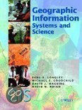
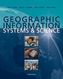
Geographic Information Systems and Science is a landmark in the evolution of GIS. It is a book that captures and redefines the richness and diversity of GIS, in an accessible form. It presents a clearly-defined path to a world of learning about GIS, using the Internet and closely-couples reference sources. It is richly produced and illustrated unlike any other in the field, with over 300 full color illustrations. Geographic Information Systems and Science is unique in several ways. It presents comprehensive treatments of: Geographic Information Science - the scientific context to GIS, technical content and geographic implications The real value of GIS - illustrated using real world applications. Treatments emphasize operational, tactical and strategic issues The impact of Internet GIS on interdisciplinary science and society The pivotal role of GIS as a business driver in the information age - including the role of GIS as a business asset and the operational dynamics of its use in practice The book is the first to provide a gateway to Internet-based classroom and distance learning. A series of modules of the ESRI Virtual Campus have been specially written around the material in this book, and detailed learning guides identify other on-line sources. Additional free supplementary reference material is available through a Web site dedicated to the book Contents The book begins by developing the themes of GI Systems and GI Science, and illustrates the practical value of GIS through real case studies. The major parts then consider: GIS Principles GIS Techniques GIS Practice A concluding section anticipates the future of GIS and prospects for the people who use it. This book is suitable for 2nd/3rd year undergraduates taking courses in GIS within departments of Geography, Environmental Science, Forestry, Business Studies and Economics, Computer Science, Information Technology, Planning, and Archaeology. It is also suitable as a foundation course taught in M. Sc. and other higher degree programs. Its user-friendly format is designed to appeal to professionals working for federal, state and local organizations. Paul A. Longley - University College London,UK David J. Maguire - ESRI, Redlands CA, USA Michael F. Goodchild - University of California, Santa Barbara, USA David W. Rhind - City University, London, UK
Negatief, positief, neutraal: we zetten een review altijd online. We controleren wel eerst of ’ie voldoet aan onze reviewvoorwaarden en niet nep is. We controleren ook of ’ie is geschreven door iemand die het artikel heeft gekocht via bol.com en zetten dit er dan bij. De controles gebeuren automatisch, al kijken er soms mensen mee. Bol.com betaalt niet voor reviews. Als een reviewer door een andere partij is vergoed, staat dit in de review zelf.
De prijs van dit product is 29 euro en 49 cent. Dit is een tweedehands product.29
49
Alleen tweedehands
Goed
.
1 - 2 weken
Levertijd
We doen er alles aan om dit artikel op tijd te bezorgen. Het is echter in een enkel geval mogelijk dat door omstandigheden de bezorging vertraagd is.
Bezorgopties
We bieden verschillende opties aan voor het bezorgen of ophalen van je bestelling. Welke opties voor jouw bestelling beschikbaar zijn, zie je bij het afronden van de bestelling.
{"pdpTaxonomyObj":{"pageInfo":{"pageType":"PDP","language":"nl","website":"bol.com"},"userInfo":{},"productInfo":[{"productId":"1001004002496101","ean":"9780470870013","title":"Geographic Information Systems And Science","price":"29.49","categoryTreeList":[{"tree":["Boeken","Wetenschap \u0026 Natuur"]},{"tree":["Boeken","Wetenschap \u0026 Natuur","Aarde \u0026 Milieu"]},{"tree":["Boeken","Wetenschap \u0026 Natuur","Aarde \u0026 Milieu","Aardrijkskunde"]},{"tree":["Boeken","Wetenschap \u0026 Natuur","Aarde \u0026 Milieu","Aardwetenschappen"]},{"tree":["Boeken","Wetenschap \u0026 Natuur","Aarde \u0026 Milieu","Aardrijkskunde","Atlassen \u0026 Wereldkaarten","GIS"]},{"tree":["Boeken","Wetenschap \u0026 Natuur","Aarde \u0026 Milieu","Aardrijkskunde","Atlassen \u0026 Wereldkaarten"]},{"tree":["Boeken"]}],"brick":"10000926","chunk":"80007266","publisher":"John Wiley And Sons Ltd","author":"Paul A. Longley","averageReviewRating":"0.0","seriesList":[],"sellerName":"BAY EXPRESS","uniqueProductAttribute":"BINDING-"}]}}
{"pdpAnalyticsObj":{"pageInfo":{"pageType":"PDP","country":"BE","shoppingChannelContextTypeAndDeviceType":"www.bol.com,SEO_AGENT","canonicalUrl":"https://www.bol.com/be/nl/f/geographic-information-systems-and-science/30037081/","shortURL":"/p/geographic-information-systems-and-science/1001004002496101/","countryLanguage":"be-nl","external":true,"subscriptionInfo":{"selectMembership":false},"shouldSendUserProps":false,"renderedInApp":false},"product":{"productId":"1001004002496101","title":"Geographic Information Systems And Science","category":"Boeken/Wetenschap \u0026 Natuur","brand":"","brick":"10000926","seller":"1580714_BAY EXPRESS","price":29.49,"discount":0.0,"categoryNumbersFlattened":["8299","23952"],"categories":["Boeken","Wetenschap \u0026 Natuur","Aarde \u0026 Milieu","Aardrijkskunde","Atlassen \u0026 Wereldkaarten","GIS"],"orderable":"available","quantity":1}}}


 56,171 - 2 weken
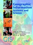 29,311 - 2 weken