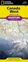
Rocky Mountain National Park Colorado, USA Outdoor Recreation Map
Afbeeldingen
Artikel vergelijken
- Engels
- Bindwijze overig
- 9781566953429
- 02 augustus 2012
- 1 pagina's
Samenvatting
• Waterproof • Tear-Resistant • Topographic Map
National Geographic's Trails Illustrated map of Rocky Mountain National Park delivers unmatched detail and valuable information to assist you in your exploration of this breathtaking wilderness. Whatever the season, you'll find this map a useful tool in pursuing a host of recreational activities from camping and fishing to skiing and snowmobiling. Created in partnership with local land management agencies, this expertly researched map features key areas of interest including Trail Ridge Road, Longs Peak, Arapaho National Forest, Routt National Forest, Roosevelt National Forest, Never Summer Wilderness, Comanche Peak Wilderness, and the Continental Divide Trail.
The Rocky Mountain National Park map can guide you off the beaten path and back again with over 400 miles of mapped trails including hiking, horse, snowmobile, cross-country ski, ATV, and mountain bike trails. The map base includes contour lines and elevations for summits, passes and major lakes. Many recreation features are noted as well, including campgrounds, trailheads, interpretive trails, boat launches, fishing access, and horse rental locations.
Every Trails Illustrated map is printed on ''Backcountry Tough'' waterproof, tear-resistant paper. A full UTM grid is printed on the map to aid with GPS navigation.
Other features found on this map include: Arapaho National Forest, Comanche Peak Wilderness, Grand Lake, Indian Peaks Wilderness, Lake Granby, Longs Peak, Neota Wilderness, Never Summer Wilderness, Rocky Mountain National Park, Roosevelt National Forest, Routt National Forest, Stones Peak.
- Map Scale = 1:50,000
- Sheet Size = 37.75'' x 25.5''
- Folded Size = 4.25'' x 9.25''
Productspecificaties
Wij vonden geen specificaties voor jouw zoekopdracht '{SEARCH}'.
Inhoud
- Taal
- en
- Bindwijze
- Bindwijze overig
- Oorspronkelijke releasedatum
- 02 augustus 2012
- Aantal pagina's
- 1
- Illustraties
- Nee
Betrokkenen
- Hoofdauteur
- National Geographic Maps
- Hoofduitgeverij
- National Geographic Maps
Overige kenmerken
- Editie
- 2016
- Extra groot lettertype
- Nee
- Product breedte
- 110 mm
- Product lengte
- 235 mm
- Studieboek
- Nee
- Verpakking breedte
- 110 mm
- Verpakking hoogte
- 8 mm
- Verpakking lengte
- 235 mm
- Verpakkingsgewicht
- 96 g
EAN
- EAN
- 9781566953429
Je vindt dit artikel in
- Categorieën
- Taal
- Engels
- Boek, ebook of luisterboek?
- Boek
- Beschikbaarheid
- Leverbaar
- Studieboek of algemeen
- Algemene boeken
Kies gewenste uitvoering
Bindwijze
: Bindwijze overig
Prijsinformatie en bestellen
De prijs van dit product is 13 euro en 77 cent.
Uiterlijk 17 mei in huis
Verkoop door bol
- Gratis verzending door bol vanaf 20 euro
- Ophalen bij een bol afhaalpunt mogelijk
- 30 dagen bedenktijd en gratis retourneren
- Dag en nacht klantenservice
Anderen bekeken ook


Vaak samen gekocht
Rapporteer dit artikel
Je wilt melding doen van illegale inhoud over dit artikel:
- Ik wil melding doen als klant
- Ik wil melding doen als autoriteit of trusted flagger
- Ik wil melding doen als partner
- Ik wil melding doen als merkhouder
Geen klant, autoriteit, trusted flagger, merkhouder of partner? Gebruik dan onderstaande link om melding te doen.