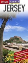
Insight Flexi Map: Guernsey Guernsey
Afbeeldingen
Sla de afbeeldingen overArtikel vergelijken
- Engels
- Paperback
- 9781780053790
- 16 januari 2014
- 2 pagina's
Insight Guides
In the late 1960's a young German graphic designer, Hans Hoefer, trekked from Europe to Asia. He was especially intrigued by Bali, where he earned a living by selling his paintings of the Indonesian island to tourists. But he was frustrated by the lack of easily available information on Bali's colorful culture and people. Where did their beliefs originate? How did their art develop?
Hoefer searched for a guidebook that would explain the island's history and culture as well as describe its tourist sites. It would give an insight into its people's values and politics. It would use strong visual images to communicate directly the atmosphere of the destination and the everyday life of its inhabitants. And it would encourage readers to celebrate the essence of the place rather than fashion it to suit their preconceptions. He couldn't find such a book, so he decided to create it. With the financial backing of a local hotel, he published Insight Guide: Bali in 1970.
The book won a photography award and a gold medal from the American Society of Travel Agents. Hoefer meticulously produced other Insight Guides to Asian destinations, all illustrated with superb, full-colour photographs.
The concept found its market in the 1980s and by the early 1990s Insight Guides to more than 100 destinations all over the world were available in different languages. To meet the demand for the books and to maintain standards of production quality, Hoefer set up his own printing plant in Singapore, which had by then become his base.
When Hoefer would meet people around the world, he was struck by the fact that even Insight Guide fans would still ask: ""Yes, but what's your favourite restaurant in Paris?"" or ""Which hotel do you use in New York?""
To cater for this demand for personal recommendation, Hoefer launched the Insight Pocket Guide series, a radical concept which filtered information through a local correspondent - the reader's equivalent of a friend in a destination. Later, a full-size, fold-out map was added to give the books added practicality.
Hoefer responded to public demand by adding a third series: Insight Compact Guides. These were portable, keenly priced mini-guides which could be carried easily and quickly consulted while on the road. The concept was adapted from a market-leading series in Germany. Realising that substantial resources would be needed to update, improve and expand, Hoefer sold his share in the company over a period of years to the Langenscheidt group, which embarked on an ambitious expansion program.
Insight FlexiMaps, the first product in this new program, were an immediate success. Their clear cartography and the ease of use and durability provided by lamination showed that Insight Guides' innovation skills were as strong as ever. In 1999, Insight Guides forged a link with Discovery Channel to produce Discovery Travel Adventures. This acclaimed series of guide books takes a thematic approach to travel in tune with the growth of special interest tourism, from birdwatching to scuba diving.
Insight has added yet more series to their collection, including Insight Shopping Guides, Insight Eating Guides, Museums and Galleries Guides, and Kids' Fleximaps.
Op bol.com vind je alle boeken van Insight Guides, waaronder het nieuwste boek van Insight Guides."Samenvatting
Productspecificaties
Inhoud
- Taal
- en
- Bindwijze
- Paperback
- Oorspronkelijke releasedatum
- 16 januari 2014
- Aantal pagina's
- 2
- Illustraties
- Nee
Betrokkenen
- Hoofdauteur
- Insight Guides
- Tweede Auteur
- Insight Guides
- Hoofduitgeverij
- Apa Publications
Overige kenmerken
- Editie
- 3
- Studieboek
- Nee
EAN
- EAN
- 9781780053790
Je vindt dit artikel in
- Categorieën
- Taal
- Engels
- Boek, ebook of luisterboek?
- Boek
- Beschikbaarheid
- Leverbaar
- Studieboek of algemeen
- Algemene boeken
Reviews
Negatief, positief, neutraal: we zetten een review altijd online. We controleren wel eerst of ’ie voldoet aan onze reviewvoorwaarden en niet nep is. We controleren ook of ’ie is geschreven door iemand die het artikel heeft gekocht via bol.com en zetten dit er dan bij. De controles gebeuren automatisch, al kijken er soms mensen mee. Bol.com betaalt niet voor reviews. Als een reviewer door een andere partij is vergoed, staat dit in de review zelf.
Negatief, positief, neutraal: we zetten een review altijd online. We controleren wel eerst of ’ie voldoet aan onze reviewvoorwaarden en niet nep is. We controleren ook of ’ie is geschreven door iemand die het artikel heeft gekocht via bol.com en zetten dit er dan bij. De controles gebeuren automatisch, al kijken er soms mensen mee. Bol.com betaalt niet voor reviews. Als een reviewer door een andere partij is vergoed, staat dit in de review zelf.
-
Insight flexi map
Positieve punten
- Toegankelijk
- Praktisch toepasbaar
Geschreven bij Insight Flexi Map Sri Lanka
Bijzonder handig formaat, niet te groet niet te klein en gedetaileerd genoeg, waterbestendig en en goed opnieuw te vouwen.
Vond je dit een nuttige review?00 -
Stevige kaart
Positieve punten
- Praktisch toepasbaar
Geschreven bij Insight Flexi Map Sri Lanka
Mooie geplastificeerde kaart, handig voor routeplanning.
Vond je dit een nuttige review?00
Kies gewenste uitvoering
Prijsinformatie en bestellen
De prijs van dit product is 37 euro en 10 cent. Dit is een tweedehands product.- Bestellen en betalen via bol
- Prijs inclusief verzendkosten, verstuurd door Bogamo 4 - Boeken outlet
- 30 dagen bedenktijd en gratis retourneren
Anderen bekeken ook


Rapporteer dit artikel
Je wilt melding doen van illegale inhoud over dit artikel:
- Ik wil melding doen als klant
- Ik wil melding doen als autoriteit of trusted flagger
- Ik wil melding doen als partner
- Ik wil melding doen als merkhouder
Geen klant, autoriteit, trusted flagger, merkhouder of partner? Gebruik dan onderstaande link om melding te doen.