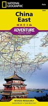
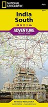
National Geographic Adventure Map India Northwest Travel Maps International Adventure Map
Afbeeldingen
Sla de afbeeldingen overArtikel vergelijken
- Engels
- Bindwijze overig
- 9781566955980
- 24 november 2011
- 1 pagina's
Samenvatting
&; Waterproof &; Tear-Resistant &; Travel Map
National Geographic's India Northwest Adventure Map provides global travelers with the perfect combination of detail and perspective. This expertly crafted map includes the locations of thousands of cities and towns with an index for easily locating them, plus a clearly marked road network complete with distances and designations for expressways, major roadways, and secondary roads. Specialty content to include hundreds of diverse and unique recreational, ecological, cultural, and historical destinations, make this map invaluable to travelers hoping to experience all the attractions the region has to offer. Among the many points of interest are national parks and reserves, botanical gardens, bird sanctuaries, temples, palaces, beaches, campsites, archaeological sites, and more. Users will find a variety of helpful travel aids on this map as well, including the location of airports, railroads, ferry routes, and harbors.
On the front side of the print map you'll find India's far northwestern corner, including the Kashmir region and the great Himalaya range, as well as the states Haryana, Himachal Pradesh, Punjab, Rajasthan, Uttarakhand, Uttar Pradesh, and the National Capital Territory. The reverse side includes coverage of the border area with Pakistan to the west, the southern part of Rajasthan and Uttar Pradesh, as well as Madhta Pradesh and the cities of Bhopal, Gujarat and Ahmadabad to the Kathiawar Peninsula.
Every Adventure Map is printed on durable synthetic paper, making them waterproof, tear-resistant and tough &; capable of withstanding the rigors of international travel.
- Map Scale = 1:1,400,000
- Sheet Size = 25.5'' x 37.75''
- Folded Size = 4.25'' x 9.25''
Productspecificaties
Wij vonden geen specificaties voor jouw zoekopdracht '{SEARCH}'.
Inhoud
- Taal
- en
- Bindwijze
- Bindwijze overig
- Oorspronkelijke releasedatum
- 24 november 2011
- Aantal pagina's
- 1
- Illustraties
- Met illustraties
Betrokkenen
- Hoofdauteur
- National Geographic Maps
- Hoofdredacteur
- National Geographic Maps
- Hoofduitgeverij
- National Geographic Maps
Overige kenmerken
- Editie
- 2020
- Extra groot lettertype
- Nee
- Product breedte
- 114 mm
- Product hoogte
- 13 mm
- Product lengte
- 235 mm
- Studieboek
- Nee
- Verpakking breedte
- 113 mm
- Verpakking hoogte
- 15 mm
- Verpakking lengte
- 233 mm
- Verpakkingsgewicht
- 89 g
EAN
- EAN
- 9781566955980
Kies gewenste uitvoering
Bindwijze
: Bindwijze overig
Prijsinformatie en bestellen
De prijs van dit product is 13 euro en 99 cent.
2 - 3 weken
Verkoop door bol
- Gratis verzending door bol vanaf 20 euro
- Ophalen bij een bol afhaalpunt mogelijk
- 30 dagen bedenktijd en gratis retourneren
- Dag en nacht klantenservice
Anderen bekeken ook
Rapporteer dit artikel
Je wilt melding doen van illegale inhoud over dit artikel:
- Ik wil melding doen als klant
- Ik wil melding doen als autoriteit of trusted flagger
- Ik wil melding doen als partner
- Ik wil melding doen als merkhouder
Geen klant, autoriteit, trusted flagger, merkhouder of partner? Gebruik dan onderstaande link om melding te doen.