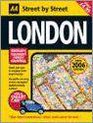
Aa Street Atlas London 2006: Midi
Afbeeldingen
Artikel vergelijken
- Engels
- Paperback
- 9780749545291
- 352 pagina's
Productbeschrijving
A new edition in the AA's ground breaking series of street atlases, covering London in a handy glovebox size. With an enlarged scale for Central London, this really is Britain's clearest street mapping. The atlas uses the latest digital data for Britain from Ordnance Survey and the AA and also includes National Grid Referencing as used by the emergency services. All of the maps clearly show recommended restaurants, hotels, one-way streets and car parks with 24-hour petrol stations now highlighted. Featuring a clever use of colour to ensure they can be read under street lighting, these maps are all you need to keep you on the move.
Productspecificaties
Wij vonden geen specificaties voor jouw zoekopdracht '{SEARCH}'.
Inhoud
- Taal
- en
- Bindwijze
- Paperback
- Aantal pagina's
- 352
Betrokkenen
- Hoofduitgeverij
- AA Publishing
Overige kenmerken
- Editie
- 4th Revised edition
- Verpakking breedte
- 154 mm
- Verpakking lengte
- 214 mm
- Verpakkingsgewicht
- 554 g
EAN
- EAN
- 9780749545291
Je vindt dit artikel in
- Categorieën
-
Kies gewenste uitvoering
Bindwijze
: Paperback
Prijsinformatie en bestellen
De prijs van dit product is 30 euro en 65 cent. Dit is een tweedehands product.Alleen tweedehands
Goed
.
.
1 - 2 weken
Verkoop door
BAY EXPRESS
- Bestellen en betalen via bol
- Prijs inclusief verzendkosten, verstuurd door BAY EXPRESS
- 30 dagen bedenktijd en gratis retourneren
Shop dit artikel
Anderen bekeken ook

Rapporteer dit artikel
Je wilt melding doen van illegale inhoud over dit artikel:
- Ik wil melding doen als klant
- Ik wil melding doen als autoriteit of trusted flagger
- Ik wil melding doen als partner
- Ik wil melding doen als merkhouder
Geen klant, autoriteit, trusted flagger, merkhouder of partner? Gebruik dan onderstaande link om melding te doen.