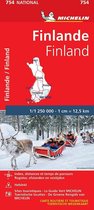
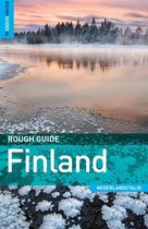
Finland And Northern Scandinavia Travel Maps International Adventure Map
Afbeeldingen
Artikel vergelijken
- Engels
- Paperback
- 9781566955324
- 15 augustus 2011
- 1 pagina's
Samenvatting
• Waterproof • Tear-Resistant • Travel Map
National Geographic's Finland and Northern Scandinavia Adventure Map is designed to meet the unique needs of adventure travelers with its detailed and accurate information. Cities and towns are easy to find in the user-friendly index. Motorways, expressways, and other roads are clearly designated and include distance in kilometers so travelers can easily plan their best route. Specialty content such as hundreds of diverse and unique recreational, ecological, cultural, and historical destinations make Adventure Maps the perfect companion to a guidebook. National parks, castles, churches, campsites, winter sports resorts, archeological sites, museums, and scenic viewpoints are among the sites noted to help you take advantage of the region's many natural attractions and activities.
The southern half of the region is shown on the front side of the map spanning from Finland's southern tip to the city of Rovaniemi in the north. Sweden's eastern coast is included from the city of Umea north to Jokkmokk. The reverse side of the map covers the northern half of the region from Norway's island of Vega north to the far reaches of its Norwegian and Barents Sea coasts. Northern Sweden is shown from Hemavan to the country's northern borders with Norway and Finland. The northern portion of Finland is included from Salla to the border with Norway.
Every Adventure Map is printed on durable synthetic paper, making them waterproof, tear-resistant and tough — capable of withstanding the rigors of international travel.
- Map Scale = 1:975,000
- Sheet Size = 25.5" x 37.75"
- Folded Size = 4.25" x 9.25"
Productspecificaties
Inhoud
- Taal
- en
- Bindwijze
- Paperback
- Oorspronkelijke releasedatum
- 15 augustus 2011
- Aantal pagina's
- 1
- Illustraties
- Met illustraties
Betrokkenen
- Hoofdauteur
- National Geographic Maps
- Hoofduitgeverij
- National Geographic Maps
Overige kenmerken
- Editie
- 2019
- Extra groot lettertype
- Nee
- Product breedte
- 108 mm
- Product hoogte
- 13 mm
- Product lengte
- 235 mm
- Studieboek
- Nee
- Verpakking breedte
- 108 mm
- Verpakking hoogte
- 235 mm
- Verpakking lengte
- 15 mm
- Verpakkingsgewicht
- 94 g
EAN
- EAN
- 9781566955324
Je vindt dit artikel in
- Categorieën
- Land
- Finland
- Regio
- Scandinavie
- Taal
- Engels
- Beschikbaarheid
- Leverbaar
Kies gewenste uitvoering
Prijsinformatie en bestellen
De prijs van dit product is 11 euro en 99 cent. De meest getoonde prijs is 13 euro en 77 cent. Je bespaart 13%.- Gratis verzending door bol vanaf 20 euro
- Ophalen bij een bol afhaalpunt mogelijk
- 30 dagen bedenktijd en gratis retourneren
- Dag en nacht klantenservice
- Vandaag nog in huis (bestel ma-vr voor 12:00, bezorging tussen 17:00 en 22:00)
- Doordeweeks ook ’s avonds in huis
- Ook zondag in huis (bestel voor za 23:59)
Anderen bekeken ook


Rapporteer dit artikel
Je wilt melding doen van illegale inhoud over dit artikel:
- Ik wil melding doen als klant
- Ik wil melding doen als autoriteit of trusted flagger
- Ik wil melding doen als partner
- Ik wil melding doen als merkhouder
Geen klant, autoriteit, trusted flagger, merkhouder of partner? Gebruik dan onderstaande link om melding te doen.