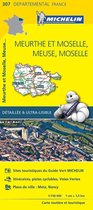
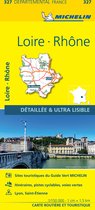
Meuse Meurthe Et Moselle Moselle Map Meurthe Et Moselle, Meuse, Moselle Map 307
Afbeeldingen
Sla de afbeeldingen overArtikel vergelijken
Michelin
Michelin is een begrip in de autowereld. Velen zullen Michelin kennen van de banden, maar ook de wegenkaarten, accessoires voor de auto/fiets en verzamelobjecten behoren tot het assortiment van Michelin. Want waar je ook naar toe gaat, zowel in je buurt als op vakantie, de producten van Michelin helpen je beter op weg te gaan. Op bol.com vind je alle boeken van Michelin, waaronder het nieuwste boek van Michelin.
Samenvatting
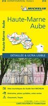
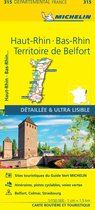
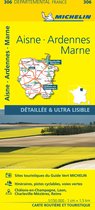
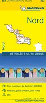
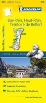
Michelin local maps are on a scale of 1:150,000 up 1:220,000 with easy to read mapping using satellite images. With additional tourist information, these maps are ideal for planning your visit. Series for France and Italy.
(Edition updated in 2018) The MICHELIN Meuse, Meurthe-et-Moselle, Moselle local map, scale 1/150,000 is the ideal companion to fully explore this area of the French Champagne-Ardenne region and provides star-rated Michelin tourist itineraries and attractions, as well as impressive 3D relief mapping. MICHELIN local maps are perfect for cyclists and outdoor enthusiasts with over 20 leisure symbols, extensive coverage of cycling paths and nature trails. With MICHELIN local maps, find more than just your way! MICHELIN LOCAL MAPS provide detailed coverage of France are perfect for fully exploring these countries and are also ideal for cyclists. * Impressive & realistic 3D relief mapping * Michelin selected itineraries and must-sees of the area * A clear and comprehensive key with 20 leisure symbols, as well as cycling paths and nature trails. * Star rated tourist sights and attractions cross-referenced with the famous MICHELIN Green Guides. * Plans of main cities and a comprehensive place name index
(Edition updated in 2018) The MICHELIN Meuse, Meurthe-et-Moselle, Moselle local map, scale 1/150,000 is the ideal companion to fully explore this area of the French Champagne-Ardenne region and provides star-rated Michelin tourist itineraries and attractions, as well as impressive 3D relief mapping. MICHELIN local maps are perfect for cyclists and outdoor enthusiasts with over 20 leisure symbols, extensive coverage of cycling paths and nature trails. With MICHELIN local maps, find more than just your way! MICHELIN LOCAL MAPS provide detailed coverage of France are perfect for fully exploring these countries and are also ideal for cyclists. * Impressive & realistic 3D relief mapping * Michelin selected itineraries and must-sees of the area * A clear and comprehensive key with 20 leisure symbols, as well as cycling paths and nature trails. * Star rated tourist sights and attractions cross-referenced with the famous MICHELIN Green Guides. * Plans of main cities and a comprehensive place name index
Productspecificaties
Wij vonden geen specificaties voor jouw zoekopdracht '{SEARCH}'.
Inhoud
- Taal
- en
- Bindwijze
- Paperback
- Oorspronkelijke releasedatum
- 01 april 2016
- Aantal pagina's
- 1
- Illustraties
- Nee
Betrokkenen
- Hoofdauteur
- Michelin
- Hoofduitgeverij
- Michelin Editions Des Voyages
Overige kenmerken
- Editie
- 16
- Extra groot lettertype
- Nee
- Product breedte
- 114 mm
- Product hoogte
- 11 mm
- Product lengte
- 250 mm
- Studieboek
- Nee
- Verpakking breedte
- 111 mm
- Verpakking hoogte
- 11 mm
- Verpakking lengte
- 195 mm
- Verpakkingsgewicht
- 198 g
EAN
- EAN
- 9782067210011
Je vindt dit artikel in
- Categorieën
- Taal
- Engels
- Boek, ebook of luisterboek?
- Boek
- Studieboek of algemeen
- Algemene boeken
Kies gewenste uitvoering
Bindwijze
: Paperback
Prijsinformatie en bestellen
Anderen bekeken ook
Vaak samen gekocht
Rapporteer dit artikel
Je wilt melding doen van illegale inhoud over dit artikel:
- Ik wil melding doen als klant
- Ik wil melding doen als autoriteit of trusted flagger
- Ik wil melding doen als partner
- Ik wil melding doen als merkhouder
Geen klant, autoriteit, trusted flagger, merkhouder of partner? Gebruik dan onderstaande link om melding te doen.