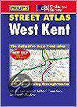
Ordnance Survey/Philip's Street Atlas West Kent
Afbeeldingen
Artikel vergelijken
- Engels
- Hardcover
- 9780540079803
- 240 pagina's
Productbeschrijving
This atlas presents detalied coverage of the West Kent region, showing every street in the area and covering both rural and urban areas. The mapping is at a standard scale of 3 inches to 1 mile with postcode boundaries. It includes a route-planning map and features emergency services, police stations, car parks and rail and bus stations locations. The atlas also contains a comprehensive index of street names and postcodes including schools, industrial estates, hospitals and sports centres - highlighted in red.
Productspecificaties
Wij vonden geen specificaties voor jouw zoekopdracht '{SEARCH}'.
Inhoud
- Taal
- en
- Bindwijze
- Hardcover
- Aantal pagina's
- 240
Betrokkenen
- Hoofduitgeverij
- Philip's
Overige kenmerken
- Verpakking breedte
- 185 mm
- Verpakking hoogte
- 57 mm
- Verpakking lengte
- 268 mm
- Verpakkingsgewicht
- 786 g
EAN
- EAN
- 9780540079803
Je vindt dit artikel in
- Categorieën
-
Kies gewenste uitvoering
Bindwijze
: Hardcover
Prijsinformatie en bestellen
De prijs van dit product is 29 euro en 48 cent. Dit is een tweedehands product.Alleen tweedehands
Goed
.
.
1 - 2 weken
Verkoop door
BAY EXPRESS
- Bestellen en betalen via bol
- Prijs inclusief verzendkosten, verstuurd door BAY EXPRESS
- 30 dagen bedenktijd en gratis retourneren
Shop dit artikel

Anderen bekeken ook
Rapporteer dit artikel
Je wilt melding doen van illegale inhoud over dit artikel:
- Ik wil melding doen als klant
- Ik wil melding doen als autoriteit of trusted flagger
- Ik wil melding doen als partner
- Ik wil melding doen als merkhouder
Geen klant, autoriteit, trusted flagger, merkhouder of partner? Gebruik dan onderstaande link om melding te doen.