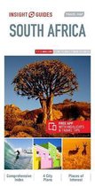
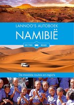
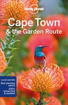
Road Atlas Southern & East Africa 1:1.500.000
Afbeeldingen
Sla de afbeeldingen overArtikel vergelijken
Auteur:
Map Studio
- Engels
- Paperback
- 9781868098439
- 15 december 2006
- 176 pagina's
Samenvatting
Overview Maps - Physical rainfall, temperature & climate of Southern Africa; Countries covered: Angola; Botswana; Democratic Republic of The Congo; Kenya; Malawi; Mozambique; Namibia; South Africa; Tanzania; Zambia; Zimbabwe; Lesotho; Swaziland; Uganda; Burundi; Rwanda; Keyplan to 6 tourist areas: Cape Peninsula; Kruger National Park & Lowveld; Kwazulu Natal Coasline; Okavango Delta & Chobe National Park; South Luangwa National Park; Victoria Falls & Living Stone. Keyplan To 20 Street Maps: Beira; Blantyre; Bulwayo; Cape Town; Dar Es Salaam; Durban; Gaborone; Harare; Johannesburg; Kampala; Luanda; Lusaka; Maputo; Nairobi; Pretoria; Windhoek; Mbabane; Maseru; Bujumbura; Kigali; Distance chart; detailed index.
Productspecificaties
Wij vonden geen specificaties voor jouw zoekopdracht '{SEARCH}'.
Inhoud
- Taal
- en
- Bindwijze
- Paperback
- Oorspronkelijke releasedatum
- 15 december 2006
- Aantal pagina's
- 176
- Illustraties
- Nee
Betrokkenen
- Hoofdauteur
- Map Studio
- Hoofduitgeverij
- Penguin Random House South Africa
Overige kenmerken
- Editie
- New title
- Studieboek
- Nee
- Verpakking breedte
- 210 mm
- Verpakking hoogte
- 297 mm
- Verpakking lengte
- 297 mm
- Verpakkingsgewicht
- 541 g
EAN
- EAN
- 9781868098439
Je vindt dit artikel in
- Categorieën
- Taal
- Engels
- Boek, ebook of luisterboek?
- Boek
- Beschikbaarheid
- Leverbaar
- Studieboek of algemeen
- Algemene boeken
Kies gewenste uitvoering
Bindwijze
: Paperback
Prijsinformatie en bestellen
De prijs van dit product is 16 euro en 95 cent. Dit is een tweedehands product.Alleen tweedehands
Goed
Paperback; Map Studio; 2007; 176 pagina's; [241680]
Paperback; Map Studio; 2007; 176 pagina's; [241680]
Op voorraad
Voor 15:00 uur besteld, vrijdag in huis
Verkoop door
Barksdale Books
- Bestellen en betalen via bol
- Ophalen bij een bol afhaalpunt mogelijk
- 30 dagen bedenktijd en gratis retourneren
- Doordeweeks ook ’s avonds in huis
Shop dit artikel
Rapporteer dit artikel
Je wilt melding doen van illegale inhoud over dit artikel:
- Ik wil melding doen als klant
- Ik wil melding doen als autoriteit of trusted flagger
- Ik wil melding doen als partner
- Ik wil melding doen als merkhouder
Geen klant, autoriteit, trusted flagger, merkhouder of partner? Gebruik dan onderstaande link om melding te doen.

