"Ordnance Survey (OS) is a national mapping agency in the United Kingdom which covers the island of Great Britain. It is one of the world's largest producers of maps. Since 1 April 2015 it has operated as Ordnance Survey Ltd, a government-owned company, 100% in public ownership. The Ordnance Survey Board remains accountable to the Secretary of State for Business, Energy and Industrial Strategy. It is also a member of the Public Data Group.
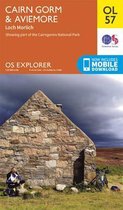
The OS Landranger Map series covers Great Britain with 204 detailed maps, perfect for day trips and short breaks. Each map provides all the information you need to get to know your local area and includes places of interest, tourist information, picnic areas and camp sites, plus Rights of Way information for England and Wales. OS Landranger now includes a digital version of the paper map, accessed through the OS smartphone app, OS Maps.
Productspecificaties
Wij vonden geen specificaties voor jouw zoekopdracht '{SEARCH}'.
Negatief, positief, neutraal: we zetten een review altijd online. We controleren wel eerst of ’ie voldoet aan onze reviewvoorwaarden en niet nep is. We controleren ook of ’ie is geschreven door iemand die het artikel heeft gekocht via bol.com en zetten dit er dan bij. De controles gebeuren automatisch, al kijken er soms mensen mee. Bol.com betaalt niet voor reviews. Als een reviewer door een andere partij is vergoed, staat dit in de review zelf.
Negatief, positief, neutraal: we zetten een review altijd online. We controleren wel eerst of ’ie voldoet aan onze reviewvoorwaarden en niet nep is. We controleren ook of ’ie is geschreven door iemand die het artikel heeft gekocht via bol.com en zetten dit er dan bij. De controles gebeuren automatisch, al kijken er soms mensen mee. Bol.com betaalt niet voor reviews. Als een reviewer door een andere partij is vergoed, staat dit in de review zelf.
Zeer goed
BerryBo
2 juli 2018
Heeft dit artikel gekocht
Positieve punten
Praktisch toepasbaar
Negatieve punten
Achterhaald
Achterhaald moet ik zeggen, maar praktisch toepasbaar.
Vond je dit een nuttige review?
0
0
Kies gewenste uitvoering
Bindwijze
: Losbladig
Prijsinformatie en bestellen
De prijs van dit product is 14 euro en 99 cent.14
99
Uiterlijk 3 mei in huis
Levertijd
We doen er alles aan om dit artikel op tijd te bezorgen. Het is echter in een enkel geval mogelijk dat door omstandigheden de bezorging vertraagd is.
Bezorgopties
We bieden verschillende opties aan voor het bezorgen of ophalen van je bestelling. Welke opties voor jouw bestelling beschikbaar zijn, zie je bij het afronden van de bestelling.