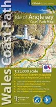
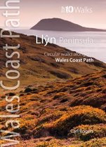
Llyn Peninsula Coast Path Map 1:25,000 scale Ordnance Survey mapping for the Llyn Peninsula section of the Wales Coast Path
Afbeeldingen
Sla de afbeeldingen overArtikel vergelijken
- Engels
- Paperback
- 9781908632609
- 04 september 2020
- 48 pagina's
Samenvatting
Enhanced, large scale (1: 25,000) Ordnance Survey mapping in a handy atlas format with all the mapping you need to walk the Llyn Peninsula section of the Wales Coast Path. Continuous OS mapping covering the Wales Coast Path between Bangor and Porthmadog. Contains extracts from large scale Explorer maps 253 and 254. - Large scale OS mapping for the complete coast of the Llyn Peninsula in a handy atlas format. - Highlighted official route of the Wales Coast Path. - On-map symbols showing amenities at main towns and villages. - Introduction with attractive photo mosaic. - Additional useful information
Productspecificaties
Wij vonden geen specificaties voor jouw zoekopdracht '{SEARCH}'.
Inhoud
- Taal
- en
- Bindwijze
- Paperback
- Oorspronkelijke releasedatum
- 04 september 2020
- Aantal pagina's
- 48
- Illustraties
- Nee
Betrokkenen
- Hoofduitgeverij
- Northern Eye Books
Overige kenmerken
- Studieboek
- Nee
- Verpakking breedte
- 107 mm
- Verpakking hoogte
- 28 mm
- Verpakking lengte
- 215 mm
- Verpakkingsgewicht
- 110 g
EAN
- EAN
- 9781908632609
Je vindt dit artikel in
- Categorieën
- Taal
- Engels
- Boek, ebook of luisterboek?
- Boek
- Beschikbaarheid
- Leverbaar
- Studieboek of algemeen
- Algemene boeken
Kies gewenste uitvoering
Bindwijze
: Paperback
Prijsinformatie en bestellen
De prijs van dit product is 11 euro en 69 cent.
Uiterlijk 16 mei in huis
Verkoop door bol
- Gratis verzending door bol vanaf 20 euro
- Ophalen bij een bol afhaalpunt mogelijk
- 30 dagen bedenktijd en gratis retourneren
- Dag en nacht klantenservice
Anderen bekeken ook

Rapporteer dit artikel
Je wilt melding doen van illegale inhoud over dit artikel:
- Ik wil melding doen als klant
- Ik wil melding doen als autoriteit of trusted flagger
- Ik wil melding doen als partner
- Ik wil melding doen als merkhouder
Geen klant, autoriteit, trusted flagger, merkhouder of partner? Gebruik dan onderstaande link om melding te doen.