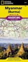
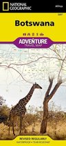
Myanmar (Burma) Travel Maps International Adventure Map
Afbeeldingen
Sla de afbeeldingen overArtikel vergelijken
- Engels
- Hardcover
- 9781597756235
- 29 februari 2016
- 2 pagina's
Samenvatting
• Waterproof • Tear-Resistant • Travel Map
National Geographic's Myanmar (Burma) Adventure Map is designed to meet the needs of adventure travelers with its detailed and accurate information. This map includes the locations of cities and towns with a user-friendly index, a clearly marked road network complete with distances and designations for roads/highways, plus secondary routes for those seeking to explore off the beaten path. Adventure Maps differ from a traditional road map because of the specialty content they include. Each map contains hundreds of diverse and unique recreational, ecological, cultural, and historic destinations — outside of the major tourist hubs. National Geographic Adventure Maps are the perfect companion to a guidebook.
Myanmar is a country with a varied landscape. From the highest peak, Hkakabo Razi, in the Hengduan Shan mountains on the border with China to the lowlands at the mouth of the Ayeyarwady River, Myanmar has almost every imaginable environment. Myanmar is bordered on the east by China and Thailand and on the west by India and a small section of Bangladesh. This crossroads of cultures has made this newly opened country a true adventure destination.
The map covers the long history of Myanmar in great detail. Over the centuries the capital of Burma has moved from Bagan in 1044 to Mandalay and finally to its current location in Yangon (Rangoon). The north side of the map includes the most mountainous area of Myanmar on the doorstep of the Himalayas. It also includes the old royal capital of Mandalay. The south side of the map includes the current capital of Yangon as well as the long border with Thailand and the hundreds of islands of the Myeik Archipelago.
Every Adventure Map is printed on durable synthetic paper, making them waterproof, tear-resistant and tough — capable of withstanding the rigors of international travel.
- Map Scale = 1:1,480,000
- Sheet Size = 25.5'' x 37.75''
- Folded Size = 4.25'' x 9.25''
Productspecificaties
Wij vonden geen specificaties voor jouw zoekopdracht '{SEARCH}'.
Inhoud
- Taal
- en
- Bindwijze
- Hardcover
- Oorspronkelijke releasedatum
- 29 februari 2016
- Aantal pagina's
- 2
- Kaarten inbegrepen
- Ja
- Illustraties
- Nee
Betrokkenen
- Hoofdauteur
- National Geographic Maps
- Hoofdredacteur
- Geographic National
- Hoofduitgeverij
- National Geographic Maps
Overige kenmerken
- Editie
- 2019
- Extra groot lettertype
- Nee
- Product breedte
- 150 mm
- Product hoogte
- 22 mm
- Product lengte
- 210 mm
- Studieboek
- Nee
- Verpakking breedte
- 108 mm
- Verpakking hoogte
- 8 mm
- Verpakking lengte
- 235 mm
- Verpakkingsgewicht
- 92 g
EAN
- EAN
- 9781597756235
Je vindt dit artikel in
- Categorieën
- Taal
- Engels
- Boek, ebook of luisterboek?
- Boek
- Beschikbaarheid
- Leverbaar
- Studieboek of algemeen
- Algemene boeken
Kies gewenste uitvoering
Bindwijze
: Hardcover
Prijsinformatie en bestellen
De prijs van dit product is 15 euro en 99 cent. De meest getoonde prijs is 21 euro en 46 cent. Je bespaart 25%.
Je bespaart 25%
Uiterlijk 17 mei in huis
Verkoop door bol
- Gratis verzending door bol vanaf 20 euro
- Ophalen bij een bol afhaalpunt mogelijk
- 30 dagen bedenktijd en gratis retourneren
- Dag en nacht klantenservice
Shop dit artikel
Anderen bekeken ook
Vaak samen gekocht

Rapporteer dit artikel
Je wilt melding doen van illegale inhoud over dit artikel:
- Ik wil melding doen als klant
- Ik wil melding doen als autoriteit of trusted flagger
- Ik wil melding doen als partner
- Ik wil melding doen als merkhouder
Geen klant, autoriteit, trusted flagger, merkhouder of partner? Gebruik dan onderstaande link om melding te doen.