Southern Scotland & Northumberland
Afbeeldingen
Sla de afbeeldingen over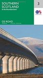
Artikel vergelijken
Ordnance Survey
(Bron: Wikipedia. Beschikbaar onder de licentie Creative Commons Naamsvermelding/Gelijk delen.)"
Samenvatting
Productspecificaties
Overige kenmerken
- Verpakking breedte
- 137 mm
- Verpakking hoogte
- 45 mm
- Verpakking lengte
- 326 mm
- Verpakkingsgewicht
- 381 g
EAN
- EAN
- 9780319263457
Je vindt dit artikel in
- Categorieën
- Land
- Engeland
- Taal
- Engels
- Regio
- Verenigd Koninkrijk
- Boek, ebook of luisterboek?
- Boek
Reviews
Negatief, positief, neutraal: we zetten een review altijd online. We controleren wel eerst of ’ie voldoet aan onze reviewvoorwaarden en niet nep is. We controleren ook of ’ie is geschreven door iemand die het artikel heeft gekocht via bol.com en zetten dit er dan bij. De controles gebeuren automatisch, al kijken er soms mensen mee. Bol.com betaalt niet voor reviews. Als een reviewer door een andere partij is vergoed, staat dit in de review zelf.
Negatief, positief, neutraal: we zetten een review altijd online. We controleren wel eerst of ’ie voldoet aan onze reviewvoorwaarden en niet nep is. We controleren ook of ’ie is geschreven door iemand die het artikel heeft gekocht via bol.com en zetten dit er dan bij. De controles gebeuren automatisch, al kijken er soms mensen mee. Bol.com betaalt niet voor reviews. Als een reviewer door een andere partij is vergoed, staat dit in de review zelf.
-
Wegenkaart
Positieve punten
- Toegankelijk
- Praktisch toepasbaar
- Heldere uitleg
Dit is geen boek, maar een wegenkaart. OS brengt de hele UK op kaart, dus herkenbare lay-out.
Vond je dit een nuttige review?10
Prijsinformatie en bestellen
Vaak samen gekocht
Rapporteer dit artikel
Je wilt melding doen van illegale inhoud over dit artikel:
- Ik wil melding doen als klant
- Ik wil melding doen als autoriteit of trusted flagger
- Ik wil melding doen als partner
- Ik wil melding doen als merkhouder
Geen klant, autoriteit, trusted flagger, merkhouder of partner? Gebruik dan onderstaande link om melding te doen.