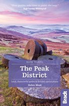
The Peak District, White Peak Area, Buxton, Bakewell, Matlock & Dove Dale
Afbeeldingen


Artikel vergelijken
Ordnance Survey
"Ordnance Survey (OS) is a national mapping agency in the United Kingdom which covers the island of Great Britain. It is one of the world's largest producers of maps. Since 1 April 2015 it has operated as Ordnance Survey Ltd, a government-owned company, 100% in public ownership. The Ordnance Survey Board remains accountable to the Secretary of State for Business, Energy and Industrial Strategy. It is also a member of the Public Data Group.
(Bron: Wikipedia. Beschikbaar onder de licentie Creative Commons Naamsvermelding/Gelijk delen.)"
(Bron: Wikipedia. Beschikbaar onder de licentie Creative Commons Naamsvermelding/Gelijk delen.)"
Samenvatting
OS Explorer is the Ordnance Survey's most detailed map and is recommended for anyone enjoying outdoor activities like walking, horse riding and off-road cycling. The OS Explorer range of OL maps now includes a digital version of the paper map, accessed through the OS smartphone app, OS Maps. Providing complete GB coverage the series details essential information such as youth hostels, pubs and visitor information as well as rights of way, permissive paths and bridleways.
Productspecificaties
Wij vonden geen specificaties voor jouw zoekopdracht '{SEARCH}'.
Overige kenmerken
- Verpakking breedte
- 136 mm
- Verpakking hoogte
- 20 mm
- Verpakking lengte
- 238 mm
- Verpakkingsgewicht
- 130 g
EAN
- EAN
- 9780319242636
Je vindt dit artikel in
- Land
- Engeland
- Taal
- Engels
- Regio
- Verenigd Koninkrijk
- Boek, ebook of luisterboek?
- Boek
Prijsinformatie en bestellen
Vaak samen gekocht
Rapporteer dit artikel
Je wilt melding doen van illegale inhoud over dit artikel:
- Ik wil melding doen als klant
- Ik wil melding doen als autoriteit of trusted flagger
- Ik wil melding doen als partner
- Ik wil melding doen als merkhouder
Geen klant, autoriteit, trusted flagger, merkhouder of partner? Gebruik dan onderstaande link om melding te doen.