"Ordnance Survey (OS) is a national mapping agency in the United Kingdom which covers the island of Great Britain. It is one of the world's largest producers of maps. Since 1 April 2015 it has operated as Ordnance Survey Ltd, a government-owned company, 100% in public ownership. The Ordnance Survey Board remains accountable to the Secretary of State for Business, Energy and Industrial Strategy. It is also a member of the Public Data Group.
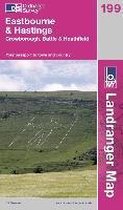
This map is part of the Landranger series and is designed for people who really want to get to know an area. It includes tourist information, camping and caravan sites, picnic areas and viewpoints, and selected places of interest.
Productspecificaties
Wij vonden geen specificaties voor jouw zoekopdracht '{SEARCH}'.
Negatief, positief, neutraal: we zetten een review altijd online. We controleren wel eerst of ’ie voldoet aan onze reviewvoorwaarden en niet nep is. We controleren ook of ’ie is geschreven door iemand die het artikel heeft gekocht via bol.com en zetten dit er dan bij. De controles gebeuren automatisch, al kijken er soms mensen mee. Bol.com betaalt niet voor reviews. Als een reviewer door een andere partij is vergoed, staat dit in de review zelf.
De prijs van dit product is 29 euro en 44 cent. Dit is een tweedehands product.29
44
Alleen tweedehands
Goed
Ref5536
Uiterlijk 30 mei in huis
Levertijd
We doen er alles aan om dit artikel op tijd te bezorgen. Het is echter in een enkel geval mogelijk dat door omstandigheden de bezorging vertraagd is.
Bezorgopties
We bieden verschillende opties aan voor het bezorgen of ophalen van je bestelling. Welke opties voor jouw bestelling beschikbaar zijn, zie je bij het afronden van de bestelling.

 29,44Uiterlijk 30 mei in huis