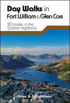
Fort William & Glen Coe 2017
Afbeeldingen
Sla de afbeeldingen overArtikel vergelijken
- Engels
- Paperback
- 9780319090916
- 10 november 2017
- 96 pagina's
Ordnance Survey
"Ordnance Survey (OS) is a national mapping agency in the United Kingdom which covers the island of Great Britain. It is one of the world's largest producers of maps. Since 1 April 2015 it has operated as Ordnance Survey Ltd, a government-owned company, 100% in public ownership. The Ordnance Survey Board remains accountable to the Secretary of State for Business, Energy and Industrial Strategy. It is also a member of the Public Data Group.
(Bron: Wikipedia. Beschikbaar onder de licentie Creative Commons Naamsvermelding/Gelijk delen.)"
(Bron: Wikipedia. Beschikbaar onder de licentie Creative Commons Naamsvermelding/Gelijk delen.)"
Samenvatting
Fort William and Glen Coe encompass one of the greatest areas of sea and mountain landscape in Scotland, backed by some of the biggest and most demanding peaks. This is Scotland's fjord land, a drowned coastland with long sea arms wending far inland, and the walks range from Fort William at sea level to Ben Nevis, the highest summit in Britain. The whole area is steeped in history, and its story is well told at local museums and information centres such as at Ballachulish, Kinlochleven and Glencoe, all areas explored in this guide
Productspecificaties
Wij vonden geen specificaties voor jouw zoekopdracht '{SEARCH}'.
Inhoud
- Taal
- en
- Bindwijze
- Paperback
- Oorspronkelijke releasedatum
- 10 november 2017
- Aantal pagina's
- 96
- Illustraties
- Nee
Betrokkenen
- Hoofduitgeverij
- Ordnance Survey
Overige kenmerken
- Editie
- 11
- Studieboek
- Nee
- Verpakking breedte
- 133 mm
- Verpakking hoogte
- 7 mm
- Verpakking lengte
- 228 mm
- Verpakkingsgewicht
- 210 g
EAN
- EAN
- 9780319090916
Je vindt dit artikel in
- Land
- Schotland
- Regio
- West-Europa, Verenigd Koninkrijk
- Taal
- Engels
- Beschikbaarheid
- Leverbaar
Kies gewenste uitvoering
Bindwijze
: Paperback
Prijsinformatie en bestellen
De prijs van dit product is 17 euro en 99 cent.
Uiterlijk 1 juni in huis
Verkoop door bol
- Gratis verzending door bol vanaf 20 euro
- Ophalen bij een bol afhaalpunt mogelijk
- 30 dagen bedenktijd en gratis retourneren
- Dag en nacht klantenservice
Shop dit artikel
Rapporteer dit artikel
Je wilt melding doen van illegale inhoud over dit artikel:
- Ik wil melding doen als klant
- Ik wil melding doen als autoriteit of trusted flagger
- Ik wil melding doen als partner
- Ik wil melding doen als merkhouder
Geen klant, autoriteit, trusted flagger, merkhouder of partner? Gebruik dan onderstaande link om melding te doen.

