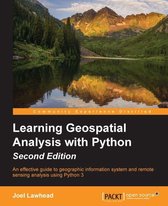
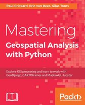
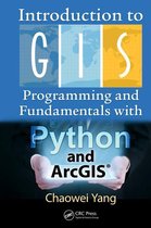
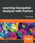
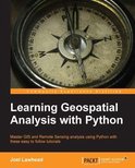
Learning Geospatial Analysis with Python Ebook Tooltip Ebooks kunnen worden gelezen op uw computer en op daarvoor geschikte e-readers. Understand GIS fundamentals and perform remote sensing data analysis using Python 3.7
- Engels
- E-book
- 9781789957938
- 27 september 2019
- 364 pagina's
- Adobe ePub
Samenvatting
Learn the core concepts of geospatial data analysis for building actionable and insightful GIS applications
Key Features- Create GIS solutions using the new features introduced in Python 3.7
- Explore a range of GIS tools and libraries such as PostGIS, QGIS, and PROJ
- Learn to automate geospatial analysis workflows using Python and Jupyter
- Automate geospatial analysis workflows using Python
- Code the simplest possible GIS in just 60 lines of Python
- Create thematic maps with Python tools such as PyShp, OGR, and the Python Imaging Library
- Understand the different formats that geospatial data comes in
- Produce elevation contours using Python tools
- Create flood inundation models
- Apply geospatial analysis to real-time data tracking and storm chasing
This book is for Python developers, researchers, or analysts who want to perform geospatial modeling and GIS analysis with Python. Basic knowledge of digital mapping and analysis using Python or other scripting languages will be helpful.
Productspecificaties
Inhoud
- Taal
- en
- Bindwijze
- E-book
- Oorspronkelijke releasedatum
- 27 september 2019
- Aantal pagina's
- 364
- Ebook Formaat
- Adobe ePub
- Illustraties
- Nee
Betrokkenen
- Hoofdauteur
- Joel Lawhead
- Hoofduitgeverij
- Packt Publishing
Lees mogelijkheden
- Lees dit ebook op
- Desktop (Mac en Windows) | Kobo e-reader | Android (smartphone en tablet) | iOS (smartphone en tablet) | Windows (smartphone en tablet)
Overige kenmerken
- Editie
- 3
- Studieboek
- Nee
- Verpakking breedte
- 191 mm
- Verpakking hoogte
- 19 mm
- Verpakking lengte
- 235 mm
- Verpakkingsgewicht
- 621 g
EAN
- EAN
- 9781789957938
Je vindt dit artikel in
- Taal
- Engels
- Boek, ebook of luisterboek?
- Ebook
- Beschikbaarheid
- Leverbaar
- Beschikbaar in Kobo Plus
- Beschikbaar in Kobo Plus
- E-book is direct beschikbaar na aankoop
- E-books lezen is voordelig
- Dag en nacht klantenservice
- Veilig betalen
Alle bindwijzen en edities (4)
-
35,99Direct beschikbaar
-
27,99Direct beschikbaar
-
55,993 - 4 weken
Levertijd
We doen er alles aan om dit artikel op tijd te bezorgen. Het is echter in een enkel geval mogelijk dat door omstandigheden de bezorging vertraagd is.
Bezorgopties
We bieden verschillende opties aan voor het bezorgen of ophalen van je bestelling. Welke opties voor jouw bestelling beschikbaar zijn, zie je bij het afronden van de bestelling.
Tooltip -
50,993 - 4 weken
Levertijd
We doen er alles aan om dit artikel op tijd te bezorgen. Het is echter in een enkel geval mogelijk dat door omstandigheden de bezorging vertraagd is.
Bezorgopties
We bieden verschillende opties aan voor het bezorgen of ophalen van je bestelling. Welke opties voor jouw bestelling beschikbaar zijn, zie je bij het afronden van de bestelling.
Tooltip
Rapporteer dit artikel
Je wilt melding doen van illegale inhoud over dit artikel:
- Ik wil melding doen als klant
- Ik wil melding doen als autoriteit of trusted flagger
- Ik wil melding doen als partner
- Ik wil melding doen als merkhouder
Geen klant, autoriteit, trusted flagger, merkhouder of partner? Gebruik dan onderstaande link om melding te doen.
